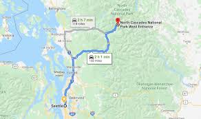
North Cascades National Park, often referred to as the “American Alps,” is a must-visit destination for nature lovers and adventure seekers alike. Located in Washington State, this vast wilderness area boasts towering peaks, pristine lakes, and some of the most rugged terrain in the United States. This guide will help you explore the park with the help of a map, covering everything from trailheads and camping spots to scenic overlooks and must-see attractions. Whether you’re a hiker, camper, or casual explorer, this North Cascades National Park map guide will help you make the most of your visit.
Overview of North Cascades National Park
Spanning over 500,000 acres, North Cascades National Park is home to diverse ecosystems, abundant wildlife, and incredible mountain scenery. The park is part of the North Cascades National Park Complex, which also includes Ross Lake National Recreation Area and Lake Chelan National Recreation Area. The landscape is shaped by glaciers, with over 300 active glaciers, making it one of the most glaciated areas in the lower 48 states.
Key Features of the North Cascades National Park Map
Using a map is essential when exploring North Cascades National Park. With rugged terrain and numerous trails, a detailed map ensures you don’t miss any of the park’s highlights. Here’s a quick look at some key features you’ll find on a map of North Cascades National Park:
- Trailheads and Hiking Trails: From beginner-friendly paths to challenging backcountry trails, the park offers hikes for all levels. Popular trails like Cascade Pass, Sahale Arm, and Maple Pass Loop are marked on the map.
- Campgrounds and Picnic Areas: North Cascades National Park offers several designated campgrounds, including Colonial Creek and Newhalem Creek Campgrounds. Maps provide locations for these areas, so you can plan overnight stays or quick rest stops.
- Visitor Centers: Essential resources like the North Cascades Visitor Center near Newhalem provide information on park conditions, permits, and ranger-led programs. Visitor centers are clearly marked on the map.
- Roads and Scenic Drives: The North Cascades Highway (State Route 20) is the main road through the park, offering scenic vistas, pullouts, and access to various trails. The highway is highlighted on park maps for easy navigation.
- Lakes and Rivers: Ross Lake, Diablo Lake, and other bodies of water are popular for kayaking, fishing, and photography. These are also marked on the map, making it easy to find viewpoints and boat launches.
Must-See Spots in North Cascades National Park
If you’re planning a visit, here are some must-see spots in the park, easily located on a North Cascades National Park map:
1. Cascade Pass and Sahale Arm
- One of the most scenic areas in the park, the Cascade Pass and Sahale Arm trails offer panoramic views of rugged peaks and lush valleys. These trails are accessible from the Cascade River Road and marked on most maps.
2. Diablo Lake Overlook
- Known for its striking turquoise waters, Diablo Lake is a popular stop along the North Cascades Highway. The overlook provides one of the best views in the park and is clearly marked on the park map.
3. Ross Lake
- Stretching 23 miles, Ross Lake is ideal for kayaking, fishing, and even backcountry camping. Maps of the park include Ross Lake, with points of interest such as the Ross Dam and various campsites.
